
Adamas to Plaka and Klima
Begin with practical orientation, then connect Tripiti, the Catacombs and Ancient Theatre before descending to Klima and climbing toward Plaka or Kastro for the final light.
 msarchia
 Milos / five-day photographic island route
Five considered days across Milos—sequenced in geographic clusters around volcanic coast, fishing villages, archaeology, sea conditions and the light that gives each landscape its clearest form.
The principle
Milos becomes coherent when each day follows one visual theatre instead of collecting beaches without regard for distance, access or light.
The route groups western archaeology and fishing villages, the lunar north coast, boat-only caves and the mineral south-east into realistic chapters. Two bases keep driving controlled; sea state, season and the strongest light remain part of the itinerary rather than last-minute complications.
Follow the five-day routeThe visual language
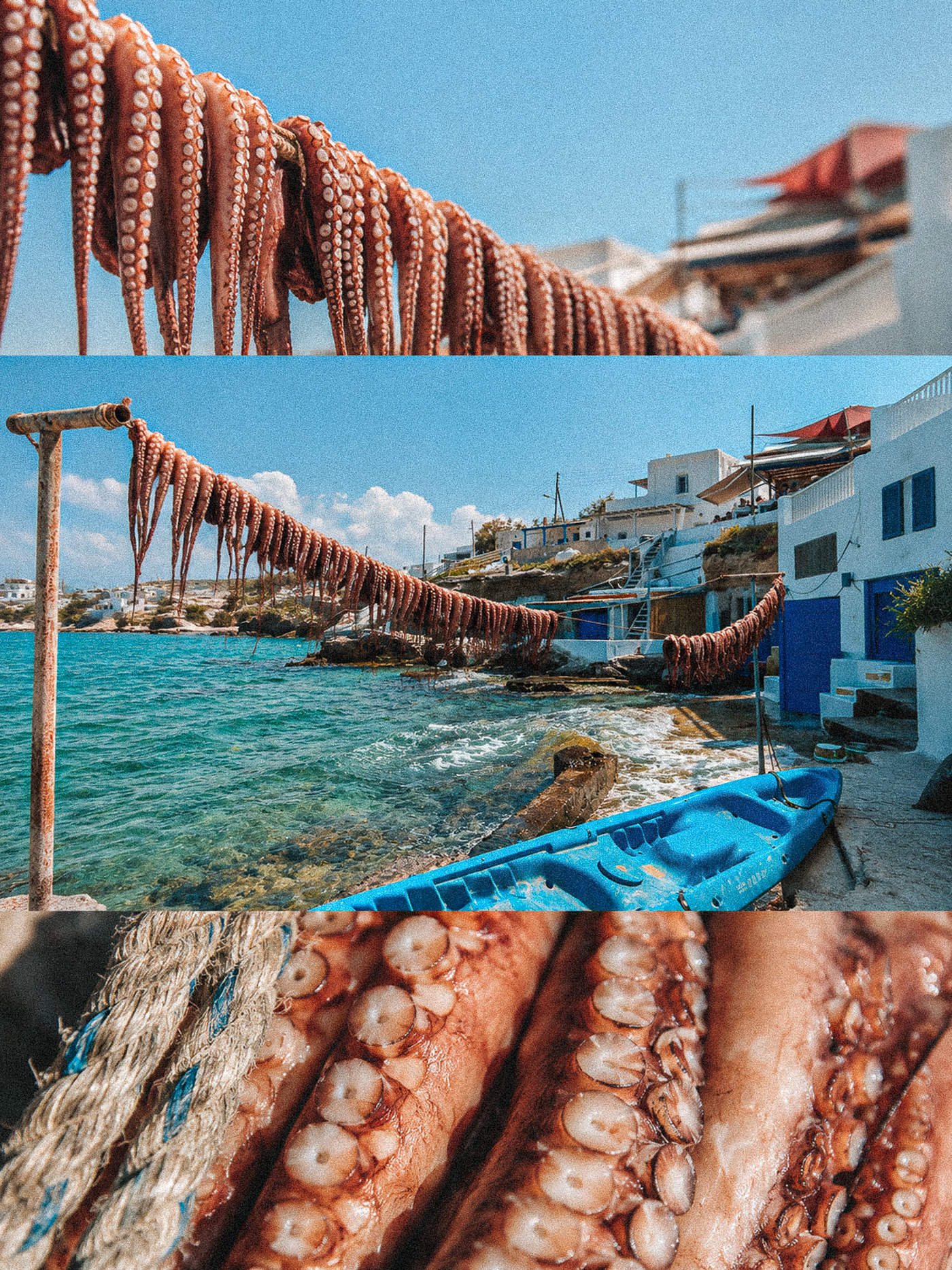
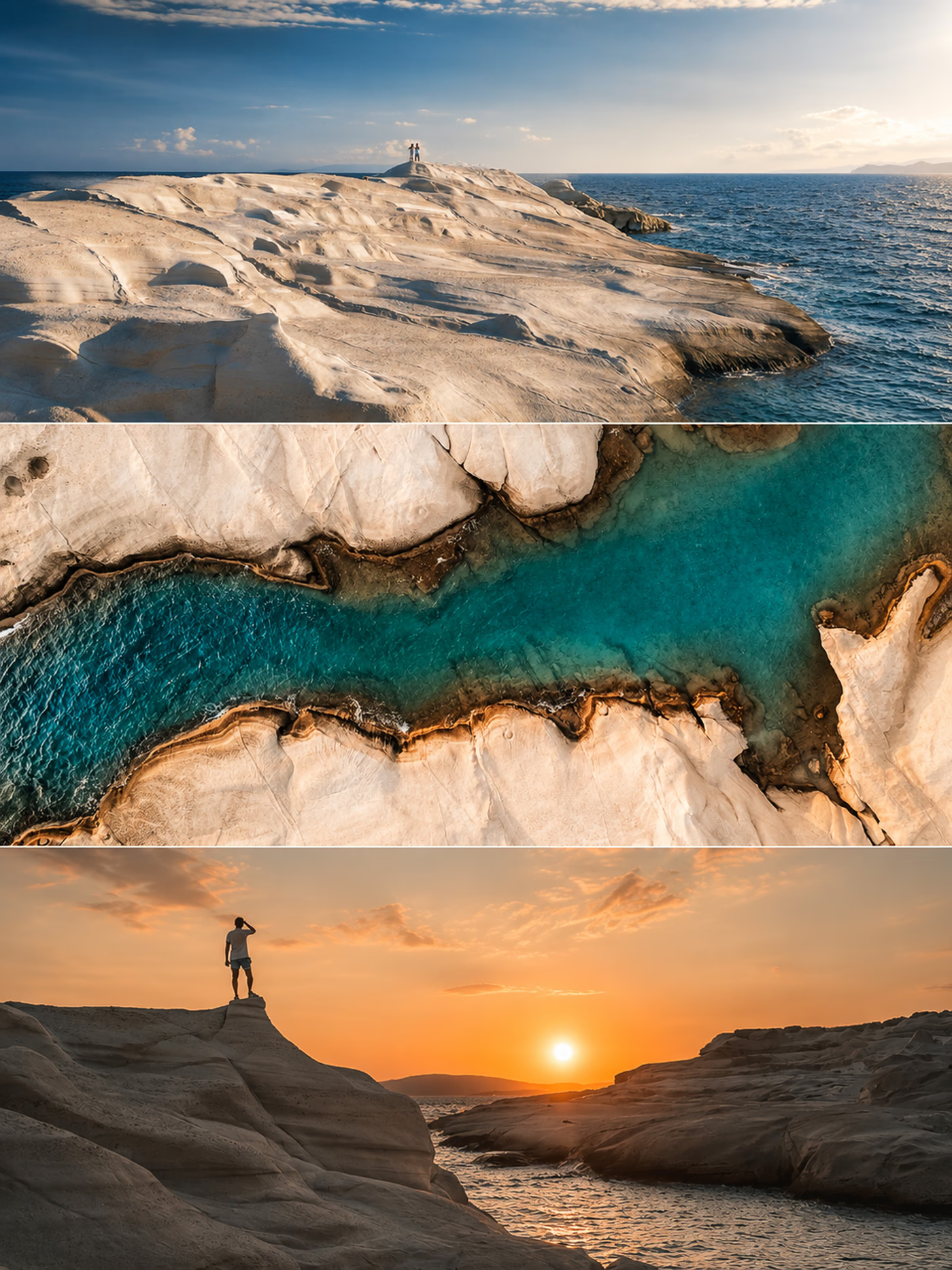
The island’s strongest photographs come from contrast: hard volcanic form against transparent sea, restrained village colour against exposed stone, and warm human traces held inside a landscape that still feels elemental.
The itinerary
Begin with practical orientation, then connect Tripiti, the Catacombs and Ancient Theatre before descending to Klima and climbing toward Plaka or Kastro for the final light.
Protect dawn for Sarakiniko, continue toward Papafragas and Phylakopi, then read Mandrakia and Firopotamos before a quieter blue-hour close in Pollonia.
Use the day for the boat-access caves and sculpted coast of Kleftiko, allowing sea state and departure conditions to decide whether the route becomes a full- or half-day chapter.
Move into the mineral south-east early, combining Paleochori with the abandoned sulfur mines at Thiorichia and returning to warm coast light without unnecessary island crossings.
Start with calm morning light in Pollonia, keep the museum as a considered option and finish at Plathiena, where the western horizon gives the island one final blue-hour frame.
Photography rhythm
Use the first light for clean rock geometry, long tonal transitions and water before the most visited northern coast begins to fill.
Higher sun can work when the subject is transparent water, sulfur earth or cave access—provided the scene is graphic enough to carry the contrast.
Return to Klima, Plaka, Pollonia or Plathiena when warm façades, fishing houses and open sea recover depth and atmosphere.
Inside the guide
A geographically coherent itinerary across the island’s western, northern, maritime and south-eastern chapters.
Coordinates and contextual notes for Plaka, the Ancient Theatre, Sarakiniko, Mandrakia, Firopotamos, Pollonia, Kleftiko, Paleochori, Thiorichia and Plathiena.
Clear recommendations for dawn, blue hour, harder daylight and the moments when each landscape becomes most legible.
Practical context for Kleftiko and other water-dependent decisions without pretending the coast behaves the same every day.
A restrained accommodation structure that reduces repeated driving while keeping the route adaptable.
Guidance for the strongest shoulder-season windows, rental-car use and realistic access across Milos.
